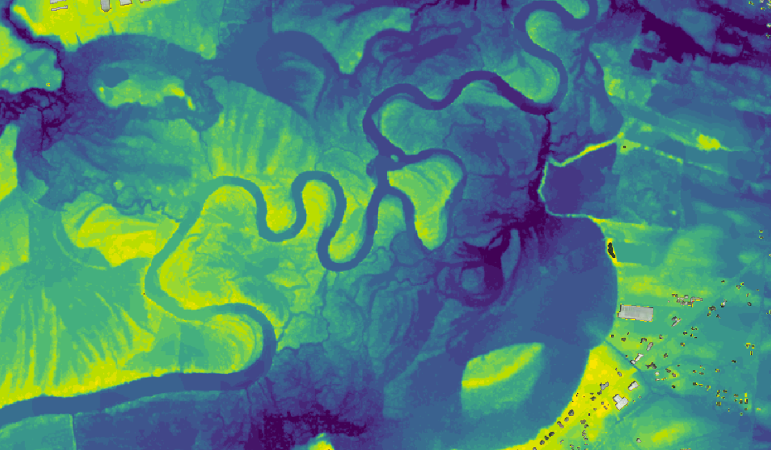
Geospatial resolution is a critical driver of accuracy in flood analytics. This is especially true for inland and urban flooding, where rainfall-driven events require highly granular data to be modeled correctly.
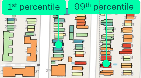
It quite literally flips the picture.
In a recent analysis, we studied 6 million buildings in New York at 1×1 meter resolution. The frequency of micro-differences having big impacts was striking — and would never have been captured at coarser resolutions.
Zooming in on a single Brooklyn block, we find properties at each end of the risk spectrum located just meters apart. They may face opposite streets or sit in different corners of the same block, yet their modeled flood risk can be completely different.
“For insurers, seeing flood risk modelled at 1×1-meter resolution enables true property-specific underwriting and pricing,” says Helge Jørgensen, CEO, 7Analytics.
Traditional flood maps generated at coarser resolution work well as a general starting point and especially for mapping fluvial risk. But when it comes to rainfall-driven surface flooding, important terrain variations that can have a big impact end up being smoothed out.
Even at 10×10 meters, the embedded uncertainty in ground elevation and estimated flood depth reaching the building can exceed the depths where most claims are generated. This holds particularly true for pluvial and flash flood damage, rendering property-level pricing challenging and instead force reliance on averages across an area or portfolio.
Model complexity can be debated. Input data quality should not. At 7Analytics, a core focus since day 1 has been on building systems capable of processing vast amounts of raw input data in a scalable way.
Our ultimate goal is supporting the industry in its ongoing transition towards confident use of ultra-high resolution geospatial models underpinning overall exposure and loss assumptions.
So that primary insurers at the forefront of this trend can apply risk reflective selection and pricing for individual properties, regardless of which zone or area they’re located in. This enables both a financially more resilient book of business, and identifying opportunities where others see risk.

Helge Jørgensen
CEO & Co-Founder